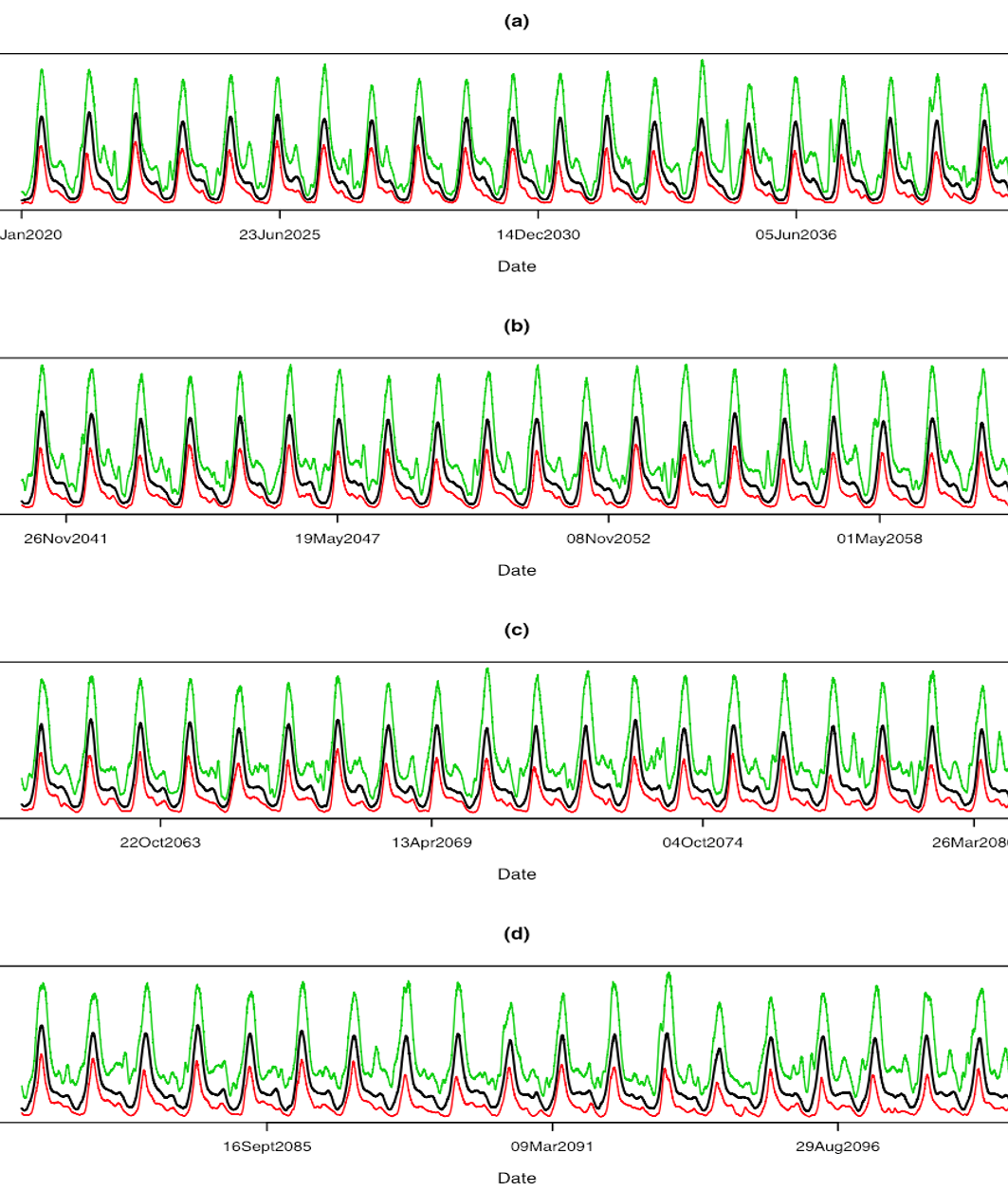
Projected daily groundwater levels at the location of a borehole from year 2020 to year 2099, where the black, red, and green curves are the estimated median and lower and upper bounds of 95% predictive intervals.
Scientific Achievement
We developed a Bayesian model to combine small-scale historical hydrological data (i.e., 47 years of streamflow data from a gaging station approximately 27 miles upstream) with large-scale, long-term climate prediction on the Upper Colorado River Basin to estimate groundwater dynamics at a floodplain site in Rifle, Colorado.
Significance and Impact
Although future groundwater levels are expected to be similar to the current levels, the timing of the high groundwater levels is predicted to occur about one month earlier. The results can be used for a watershed reactive transport model to predict how climate-induced changes will influence future biogeochemical cycling
Research Details
- Predict groundwater dynamics using historical streamflow and climate information
- No significant trends found in future groundwater levels at the Rifle study site
- Peak groundwater levels occur one month earlier towards the end of this century
Citation
Chen, J., Hubbard, S. S., Williams, K. H., and Ficklin, D. L. (2016), Estimating groundwater dynamics at a Colorado River floodplain site using historical hydrological data and climate information, Water Resources Research, 52(3), 1881-1898. DOI: 10.1002/2015WR017777
