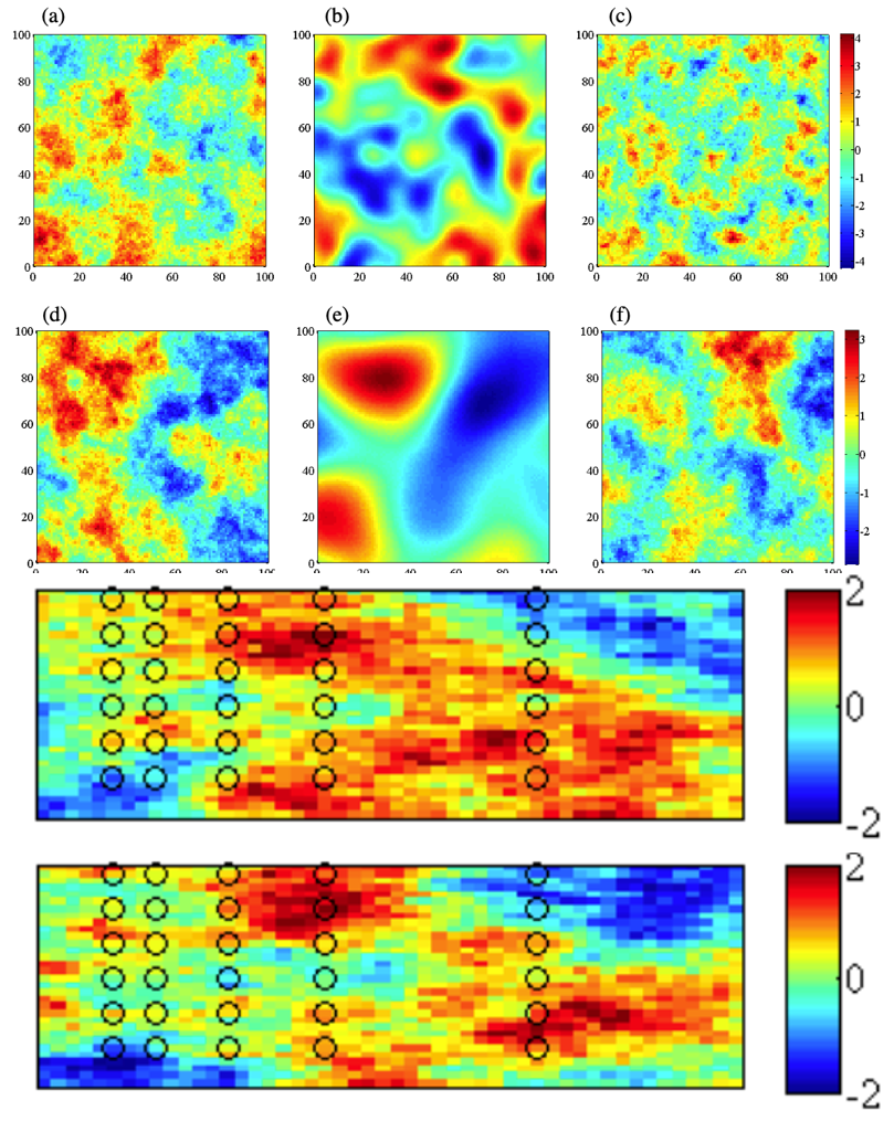
Rows 1-2 rows: Synthetic random field with different covariance functions and scales.
Row 3: Two equally likely randomly generated fields in the same parameter as in Row 4. the spectral method was used.
Scientific Achievement
We present a comprehensive description of spatial analysis and geostatistics as a set of numerical techniques to characterize spatial attributes and tackle next-generation research challenges in socio-hydrologic fields.
Significance and Impact
This chapter appears in the Handbook of Applied Hydrology, which is the next version of the classic Handbook of Applied Hydrology, edited by Professor V.T. Chow, almost 50 years ago. A summary of various spatial and temporal data types and their analyses using several techniques is provided.
Research Details
- Described various data types and methods, including data mining techniques such as cluster analysis, wavelet analysis
- Presented how to infer and represent structural information of heterogeneous model or data using heterogeneous field estimation and simulation, kriging and co-kriging, Gaussian field simulation, facies-based simulation, simulated annealing, etc.
- Discussed estimating geostatistical parameters using a multi-physics joint inversion approach
Citation
Dwivedi, D., B. Dafflon, B. Arora, H.M. Wainwright, and S. Finsterle (2016). Chapter 21: Spatial Analysis and Geostatistical Techniques, in Handbook of Applied Hydrology, V. P. Singh (ed.). McGraw-Hill, SBN-13: 978-0071835091.
