With the onset of warm weather, field work activities in the watershed have really ramped up over the past month. Both Berkeley Lab staff and our DOE-funded University and USGS cohort have been working at multiple sites to quantify the consequences of early snowmelt on ET tied to the manipulation experiments, install sap flow sensors on multiple tree species at multiple sites, examine shale bedrock properties, measure stream discharge and build new rating curves, and much, much more. Additionally, members of the SLAC “Groundwater Quality” SFA — led by PI John Bargar — have greatly ramped up their research footprint in the Slate River valley. We look forward to hearing an update from John this fall on their research progress.
Stream flows are now sufficiently low as to make wading and working within the stream corridor safe. That said, workers crossing and working in streams are reminded to exercise care and to wear appropriate gear, such as waders, wading boots, and hiking pole(s). A virtual site visit can be found here of my recent trip to the large, off-channel wetland complex upstream of the Pumphouse. This site has been an important testbed for the DOE-funded research project led by Marty Briggs (USGS) and his co-investigators Fred Day-Lewis (USGS) and Lee Slater (Rutgers Univ.). Marty will update us on this work during next week’s call.
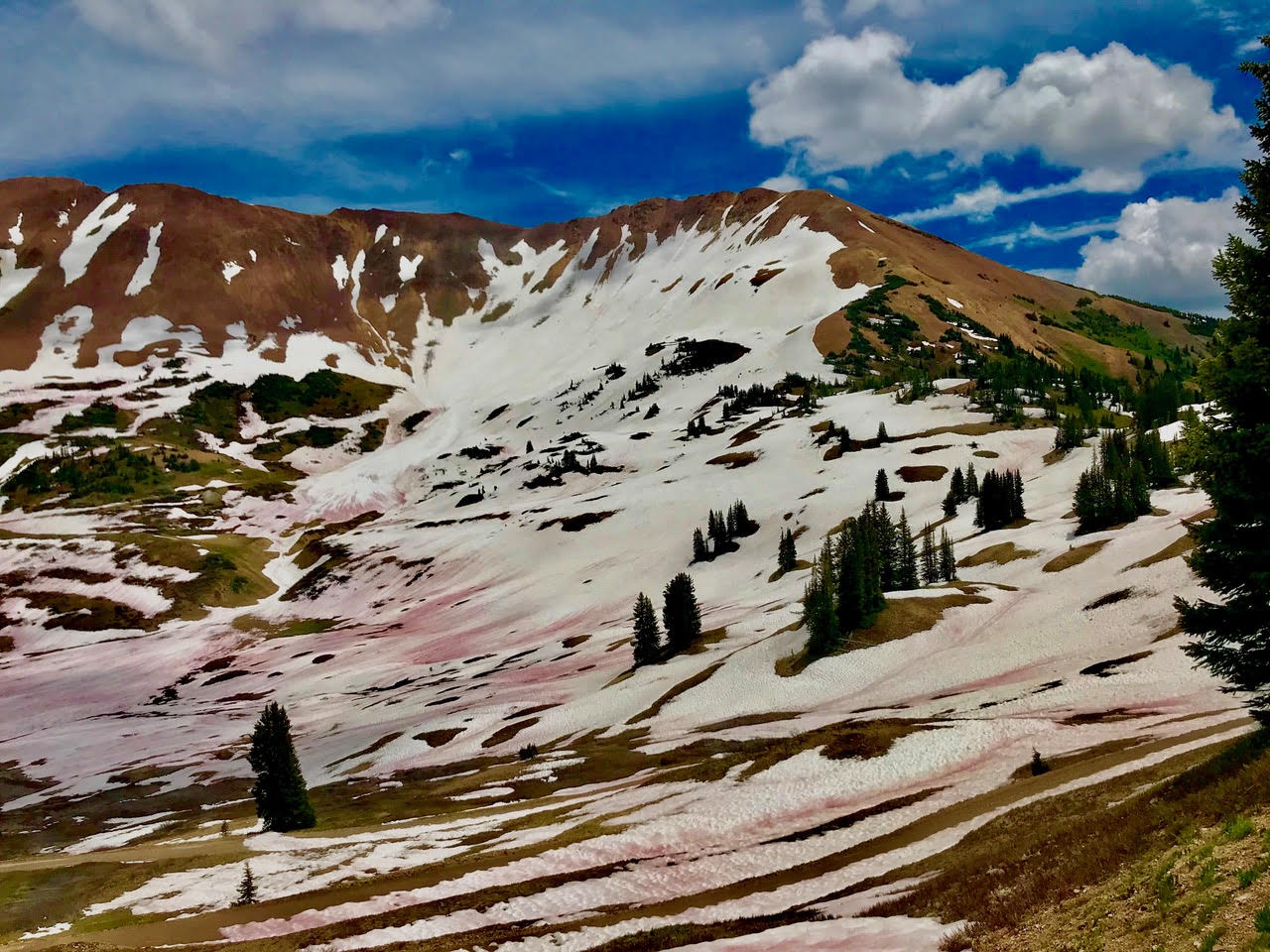
Road access to Schofield Pass from Gothic via Emerald Lake is still not possible given persistence of the snow plug. Access to the Paradise Divide and our alpine study site on Cinnamon Mountain is possible, however, lingering snow in the Paradise Basin and the approach to Schofield Pass from the north is still preventing vehicular travel at last report. Below are two beautiful shots of Paradise Basin and the mineralized faces of Mt. Baldy and Cinnamon Mountain courtesy of Rosemary Carroll (DRI).

Wildflower season is at or near peak at many locations within the watershed. For those who have recently been at East River or will be soon, it’s a glorious time to be working at the site.
With the flowers come the arrival of the nuisance flies, which aren’t a problem if you’re actively moving or it’s windy. If it’s calm or you’re working in one place, I recommend lightweight, long-sleeve shirts and pants and possibly face netting. We have had one instance in the past where bites from these flies triggered an allergic reaction, so definitely be mindful of their potential impact while you’re working.
The US Forest Service (USFS) has released a vegetation management plan for the Taylor River Basin that may be of considerable interest to members of our Science Community. The plan can be found here and it may represent a strategic opportunity for catchment scientists on our extended team to investigate the impacts of forest management practices on flows of water and nutrients. Interested individuals should feel free to reach out to me and I’m happy to help make arrangements to speak with USFS staff in person or remotely. This could be a strategically important opportunity given our team’s current expansion into the Taylor River Basin tied to the NASA Airborne Snow Observatory data being collected there, as well as work led by David Gochis (NCAR) that he will describe during next Tuesday’s call.
Working with the USGS Colorado Water Science Center, we have submitted the Gunnison River Basin as one of four HUC-4 basins that headwater in the state as possible candidates for the next USGS Next-Generation Water Observing System (NGWOS). The other candidate basins include the Colorado River main stem, the San Juan, and the upper Rio Grande. The NGWOS program is designed to “provide high-fidelity, real-time data on water quantity and quality necessary to support modern water prediction and decision support systems for water emergencies and daily water operations” with the first NGWOS basin being the Delaware River. Should one of the Colorado basins be chosen, it would represent an excellent opportunity for further engagement between our Science Community, the two DOE SFA programs, and our University colleagues to participate in an important USGS-led national effort. I will keep this group updated on the selection process as it proceeds.
Vehicular access to Snodgrass Mountain is currently not allowed. RMBL is currently sorting out land ownership and access issues for the road used for servicing the RMBL weather station at the top of the mountain. While this road has been used by our group in the past to ferry heavy equipment and would be needed for any future drilling activities in 2020 and beyond, no vehicular access is allowed until further notice. Per my last message to the group, all Snodgrass research plans and activities must be clearly communicated with ample notice to Jennie Reithel (RMBL) and myself.
Restrictions are now in place for the Crested Butte Mountain Resort (CBMR) parking lot at their maintenance & operations building. This lot is where our team parks, stages, and drives through en route to the Pumphouse site. Outside of normal business hours for CBMR, which run 7 days a week, a locked red gate may now block vehicular access to Pumphouse. Tied to our Memorandum of Agreement (MOA) with CBMR, I do have the gate code and will provide it to those staff working at the Pumphouse site outside of normal business hours. Please contact me in advance if there’s a likely need to work at times when the gate may be locked. Note that with the recent purchase of CBMR by Vail Resorts, I am currently renewing the MOA and will plan to leave hard copies of it at the SFA Red Lady House for personnel to keep in their vehicles when accessing the site. We’ve not had any issues to date, and I’d like to keep it that way given the importance of CBMR as a local stakeholder.
