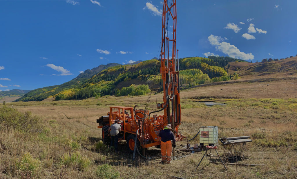
I wanted to update everyone on the recent shale drilling campaign that wrapped up on Tuesday after 8 days of high productivity and perfect weather.
In brief: We accomplished 100% of what we set out to accomplish.
A more detailed accounting of the work follows:
(a) We set the rig up on well #PLM5 on Tuesday AM, which is the 230-foot borehole from which we collected the continuous core last October. This well had stability issues and collapsed in several places last year before we had to abandon the site due to bad weather. We were able to readily clear the hole back down to 230-feet and added four nested piezometers to sample and monitor conditions at four discrete depths:
3-13 feet
40-80 feet
125-165 feet
210-230 feet [N.B. shale from this depth interval corresponds to the same stratigraphic unit encountered in PLM6, our toe slope well.]
(b) Upon finishing that work, we offset the rig by about 15-feet along the geologic strike direction and drilled a parallel 230-foot hole (well #PLM7) that was cased with 3” slotted PVC and which will be used for geophysical wireline logging, including NMR-derived permeability estimation, and hydrologic testing (e.g. pumping and injection tests).
Regarding that testing, we got an unexpected “jump-start” on that activity. Our rate of penetration (ROP) slowed over the 35-50 foot depth interval, and after checking my core logging notes from last year, I was reminded I’d identified a putative fault zone complete with clay gouge in this interval. While drilling through this interval, we observed water flow from the 40-80 foot piezometer in PLM5 that we interpret to be migration of injected drilling fluids (East River stream water) along the highly conductive fault zone and breakthrough at the consistent depth in PLM5. When drilling stopped, flow from the piezometer would stop; when resumed, flow resumed. Drilling past the 50-foot depth resulted in cessation of flow from the piezometer suggesting a max. depth of the fault zone.
A virtual site visit of the PLM7 drilling site can be found here.
The ROP also slowed down considerably over the last 20-feet consistent with our observations in 2018 and the transition to a different unit of the Mancos shale. So it appears that we have good stratigraphic correlation between the two wells — PLM5 with its nested piezometers and PLM7 with its 3” borehole — that should nicely link the geophysical logging data with the shale core collected in 2018 and currently stored at the USGS core library.
Protective metal well enclosures were added to both PLM7 and PLM8 and we will need to make sure snow poles are added to both locations as the route of the Grand Traverse ski race passes very close to their location and we want to avoid damage when plowing for the route occurs. Our point of contact with Vail Resorts, Mark Voegeli, is cc’ed here to keep him in the loop.
***I’d like to strongly encourage anyone on this email list who has an interest in and aptitude for fractured rock characterization to contact me at their earliest convenience, as the PLM7/8 system is well suited to more detailed hydrological investigations. Let’s talk!
(c) We moved across the East River to well #PLM8 and cored from 0-71 feet, with this location designed to compared aspect controls (N-NE facing vs. S-SW facing) on shale weathering. Recovery over the upper 10-feet was rather poor, so a second shallow hole was used to collect a combination of Shelby tube and split spoon samples. In general, the saprolite / weathering zone here seems just a little shallower than at PLM7 transitioning to what appears to be unweathered bedrock at a depth of 11-feet (3.35-m). In contrast, the weathering zone samples are extremely clay rich likely accounting for the poor core recovery. The unweathered shale bedrock is extremely competent over the entire 11-71 foot interval with very few of the conductive fractures observed at PLM7. Indeed, the fracture water holding capacity of the shale unit at PLM8 appears much less than the upper 200-210 feet of shale at PLM7. This is perhaps not unexpected, given that PLM8 is located down-section stratigraphically from PLM7 (and PLM6) and clearly represents a different shale member and/or facies type.
A 3” well was put in place to allow for geophysical wireline logging from 0-71-feet, and an offset, shallow piezometer from 4.5-9.5 feet was installed to monitor and sample the saprolite / weathering zone.
A virtual site visit of the PLM8 drilling site can be found here.
A photo of this location is attached with the view across the river showing the location of the existing PLM transect, with PLM8 being a deeper clone of our toe slope well PLM6 on the opposite bank.
(d) Three alluvial aquifer wells (2” ID) were installed along the Pumphouse Meander A to D transect. All three wells encountered weathered shale bedrock at a consistent depth of ~15-feet. These wells are being used by Amanda DelVecchia (NC State) for quantification of subsurface carbon flows between trophic levels including stoneflies that assimilate carbon from subsurface methanogens.
(e) Well #GUM1 (Gothic Upper Montane-1) was completed such that it is now fully cased with 3” screen to ground surface. We had lost 120-ft of casing in the hole last year and were not able to fish it out and add an additional 40-ft of screen due to bad weather and a need to halt drilling for the year. This well located on RMBL property is now completed and a protective metal well head was placed over it.
(f) A protective metal well head was added to well #GLS1 (Gothic Lower Subalpine), which is the 3” well successfully installed last year at the fishing bridge upstream of Gothic.
A big thanks to Authentic Drilling for an extremely successful outing this year. Our 3+ week advance start to drilling as compared to last year really made a difference.

