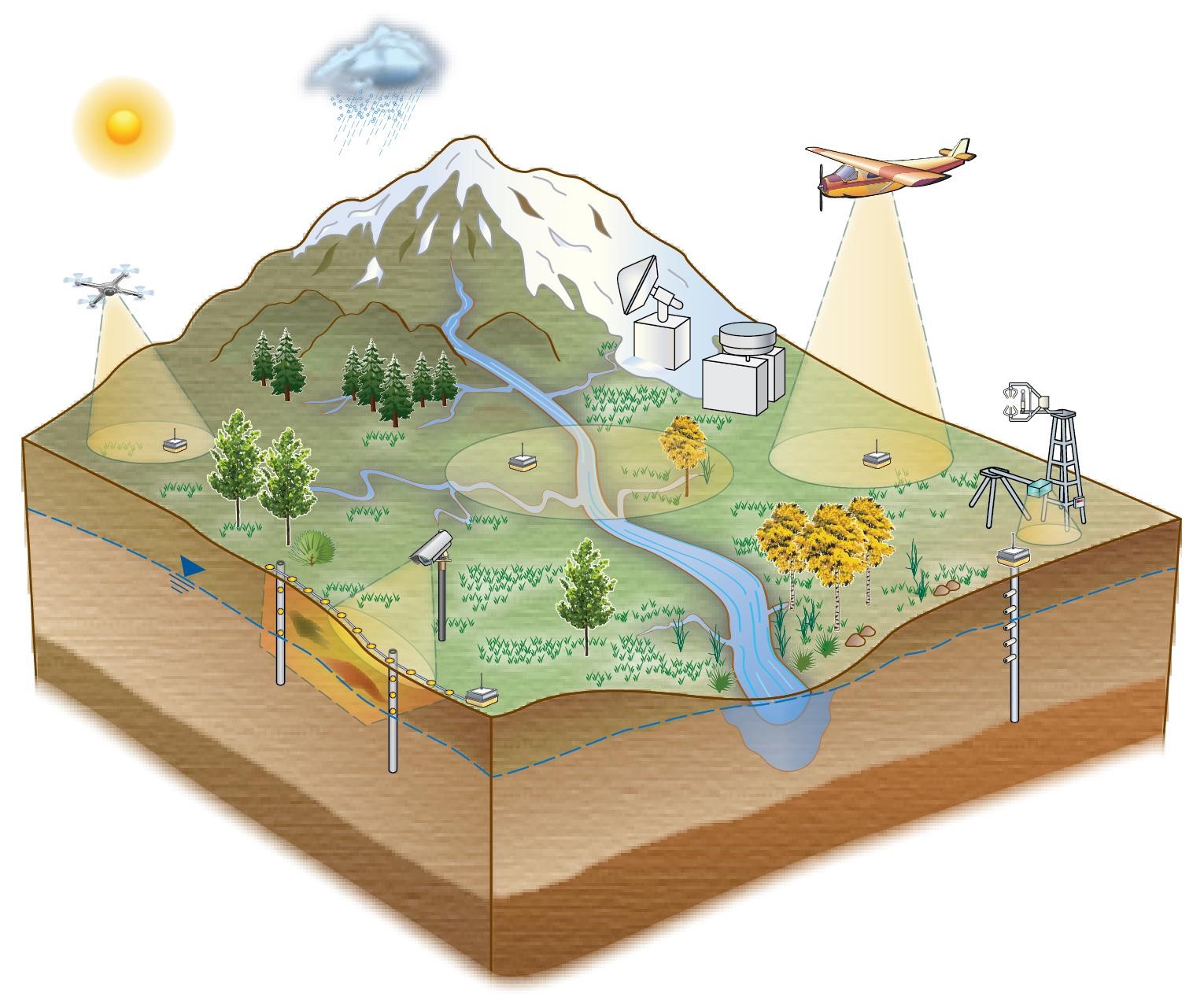
A visual representation of the diverse infrastructure and heterogeneous data collection activities at the East River Watershed. Figure from Kakalia et al. (2021)
The Science
The U.S. Department of Energy’s East River Community Observatory located in the East River watershed, Colorado, USA is a representative mountainous, snow-dominated system containing a diverse collection of sensors, water quality stations, experimental plots, and sample collection sites paired with remote sensing measurements and modeling activities. Data generated at the site are used to examine watershed system behavior and the impact of environmental perturbations, such as drought and early snowmelt, and are broadly relevant to the study of mountainous systems worldwide. Over 70 datasets are presently publicly available from multiple data repositories, with all having an open data policy.
The Impact
Hydro-biogeochemical data generated at the East River watershed are made publicly available for use by the global scientific community, allowing for collaboration across institutions and Federal and State Agencies. The co-located, interdisciplinary data collected at the East River watershed provide a comprehensive view of the environmental processes underlying watershed system function. Data types can be combined to find correlations between hydrological, biological, and chemical processes, with subsequent data analyses used to advance a predictive understanding of water quality and quantity in mountainous regions across the United States.
Summary
Research conducted at the East River (ER) watershed is broadly representative of mountainous headwater systems given the diversity of environmental gradients encompassed by its four principle drainages: East River, Washington Gulch, Slate River, and Coal Creek. The ER has both long-term and spatially-extensive observations and experimental campaigns carried out by the Watershed Function Scientific Focus Area (SFA) and researchers from over 30 organizations who conduct cross-disciplinary, process-based investigations and modeling of watershed system function. Collectively, the SFA and its collaborators generate diverse datasets including hydrological, (bio)geochemical, climate, vegetation, geophysical, microbiological, and remote sensing data. Additionally, predictive modeling datasets, including inputs, outputs and preprocessing codes are generated from numerical simulations of different watershed subsystems and their aggregated behavior. This paper highlights the acquisition and management of these diverse data products and describes where 71 public datasets can be accessed.
Citation
Kakalia, Z., Varadharajan, C., Alper, E., Brodie, E. L., Burrus, M., Carroll, R. W. H., Christianson, D. S., Dong, W., Hendrix, V. C., Henderson, M., Hubbard, S. S., Johnson, D., Versteeg, R., Williams, K. H., & Agarwal, D. A. (2021). The Colorado East River Community Observatory Data Collection. Hydrological Processes, 35(6), e14243. https://doi.org/10.1002/hyp.14243
